East Boston Development
This project is a master plan for a plot in East Boston that was the site of an old Cotton Mill and called for the design of housing, office space, and retail.
The project began with a study of the site at two scales- that of the neighborhood and one that spoke to the larger network with Boston’s neighboring cities and towns. We were then asked to create an urban framework that we would use as the basis for our designs. After these site analyses were completed, we spent the remainder of the semester furthering our ideas and urban strategies.

For the initial study of the site, I chose to look at the idea of self sustainability in East Boston. I was also interested in mapping out what daily life must be like for a resident in the neighborhood. In the mapping on the right, I pinpointed different amenities throughout the neighborhood ranging from fast food restaurants to community centers, as well as nearby bus and subway stops.
I formulated the diagrams below showing what I believed to be the different urban elements in the neighborhood. I then identified the issues I saw with the structure and functionality of the neighborhood as an urban space. I reached the conclusion that lots North of our site were much larger and generally related to industrial or commercial programs, while the lots South of the site were more quaint and small scale housing streets. The tension between these two very different characters became the main driving force of my project. I wanted to create a space that would bridge the gap between the lots North and South of the site.
Regional Mapping studying the idea of self sustainability in East Boston by identifying different amenities in the neighborhood, as well as access to public transportation and travel times
Diagram showing the “undesirable” sites for the neighbors
Diagram showing the break up of “districts” in the area
Diagram showing what I characterized as man-made versus natural “edges”
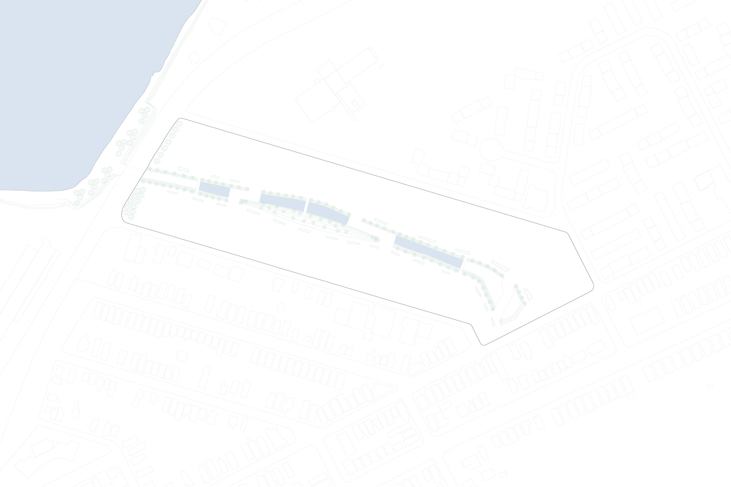
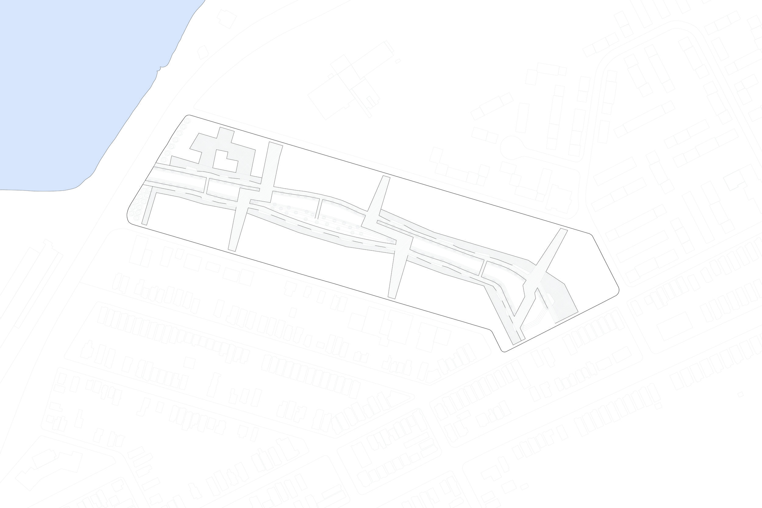
Site Plan showing the master plan design. The park in the center acts as a dynamic and lively buffer zone between the lots to the North and those to the South.
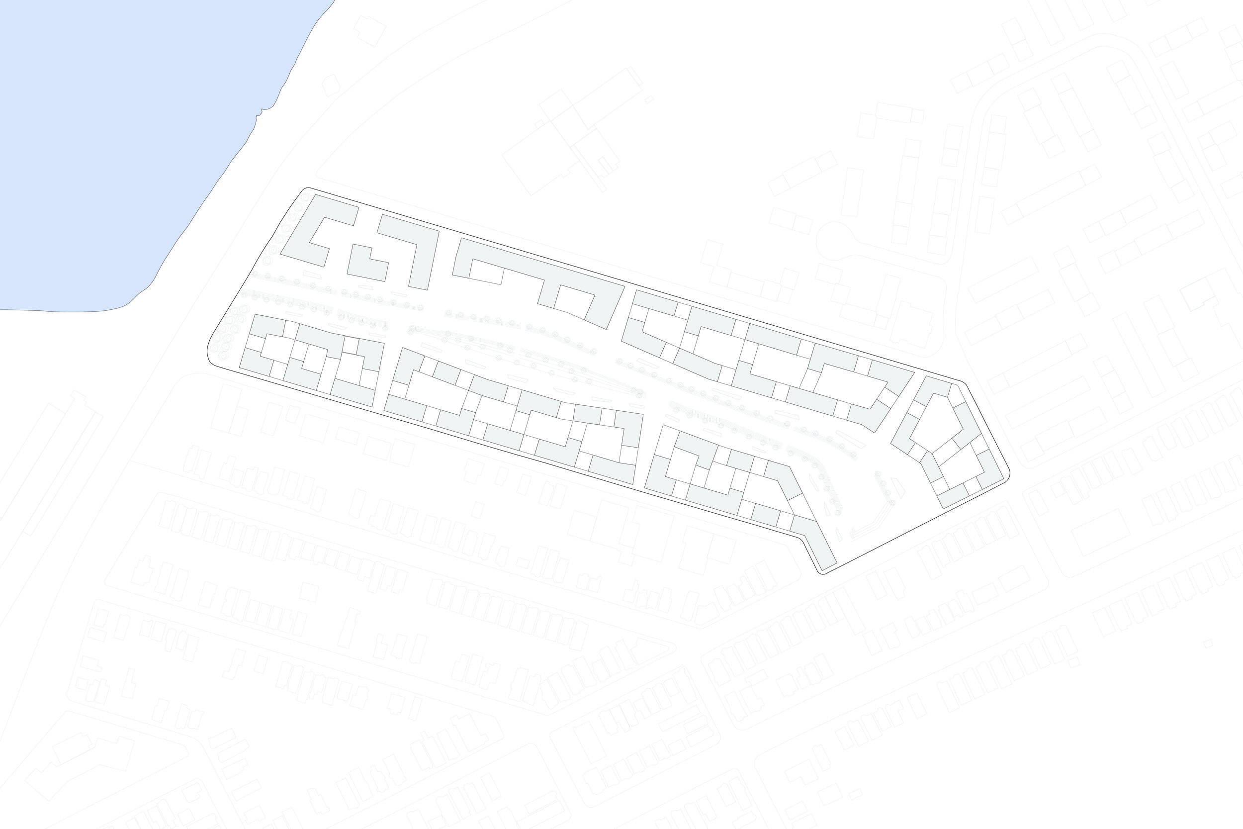
Site Plan showing the ground floor level and the way the residential buildings interact with the central park
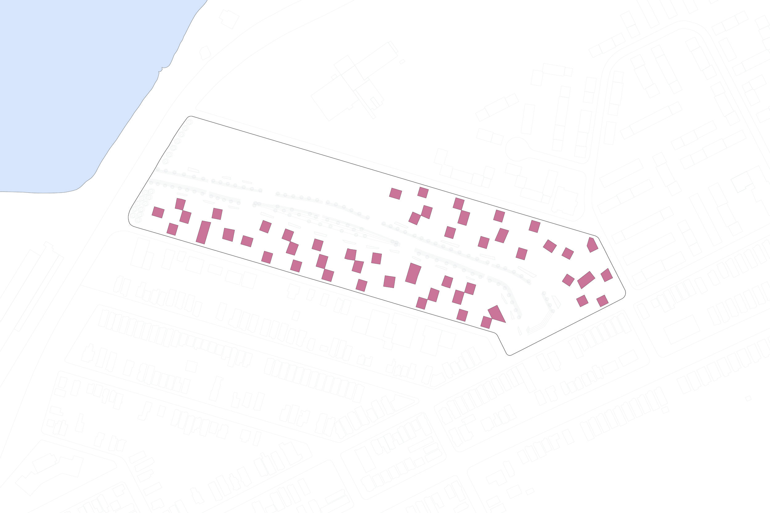
Exploded Axonometric Drawing showing the division of program on the site, which was mostly housing, but also office and retail space.


Exterior Rendering showing the relationship of the promenade to the canal park, ground floor retail, and terrace elements, which allow for diverse amenities throughout the site
Model Photos showing the relationship between the promenade, residential buildings, terrace elements, and park
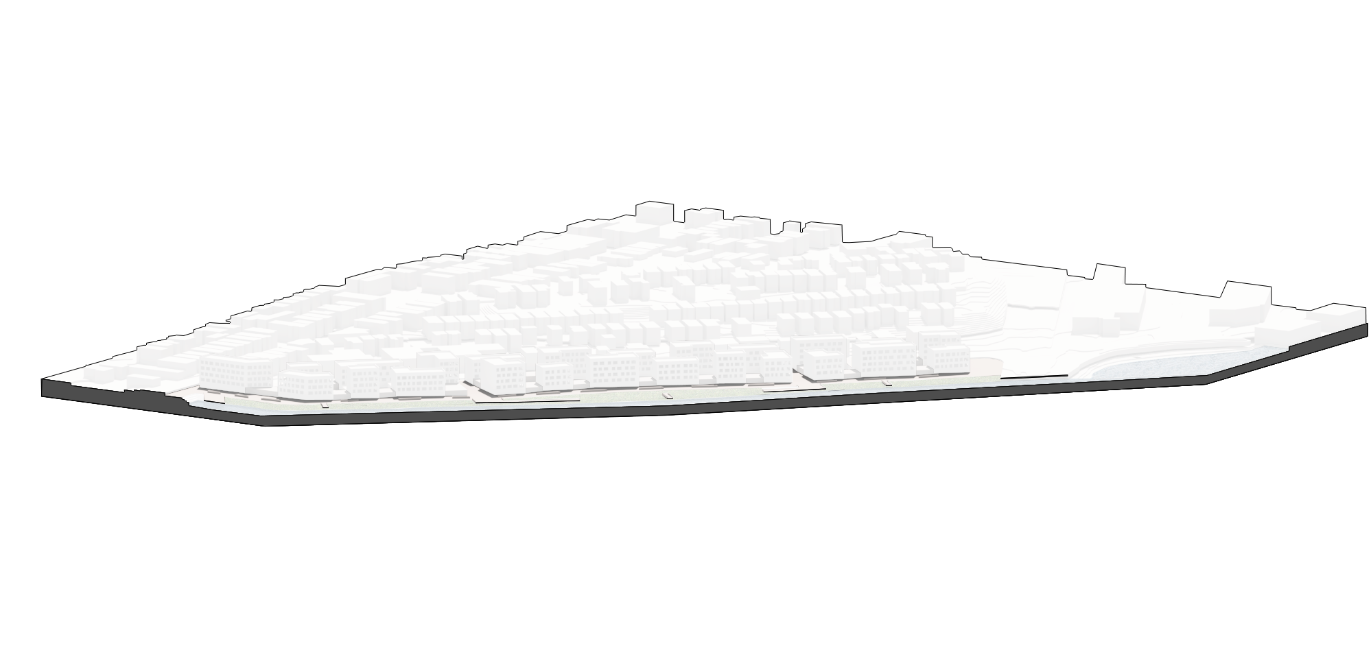
Model Photo showing the the development within its surrounding context